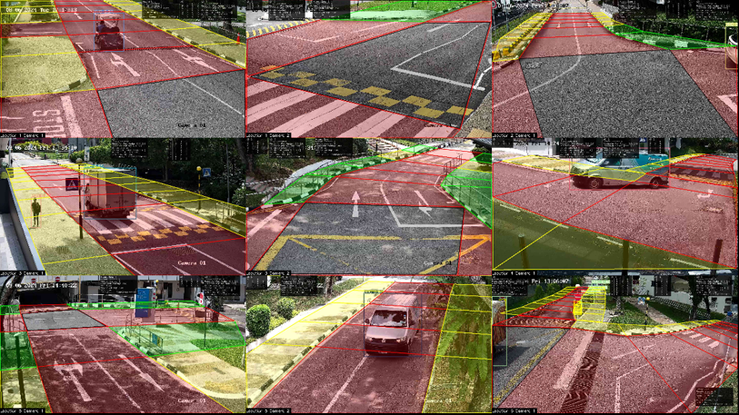
eRaC (Real-time Risk Assessment Cooperative mode) informs drivers in advance of potential hazardous events at specific times and locations, allowing sufficient reaction time. ReRaC provides real-time risk data, focuses on unregulated traffic areas, and delivers remote warnings and event detection.
Problem statement:
Most accidents occur because drivers fail to maintain proper awareness, lacking sufficient environmental information to foresee potential hazards.
Project Implementation:
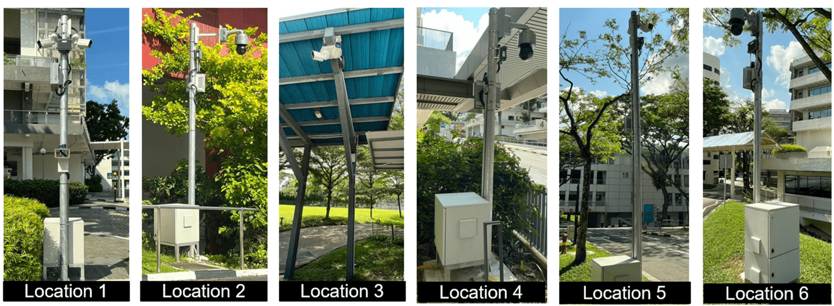
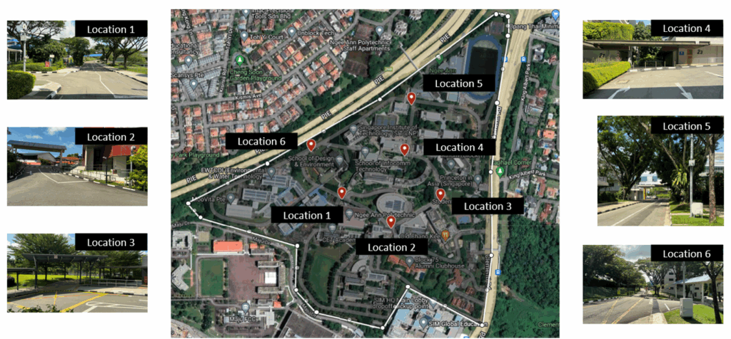
The concept is deployed and tested at Ngee Ann Polytechnic, where drivers use a mobile application to evaluate its effectiveness in providing remote warnings and detecting events.
Acknowledgements
- This work was supported by the National Research Foundation, Singapore, and the Land Transport Authority of Singapore under its Urban Mobility Grand Challenge Programme (UMGC-L013). Any opinions, findings and conclusions or recommendations expressed in this material are those of the author(s) and do not reflect the views of National Research Foundation, Singapore and the Land Transport Authority of Singapore
- Lead PI is from SIT A/P Dan Chia Wei Ming. The project is a collaboration between Singapore Institute of Technology, MooVita, University of Glasgow Singapore and Strides
![[FA] SIT One SITizen Alumni Initiative_Web banner_1244px x 688px.jpg](/sites/default/files/2024-12/%5BFA%5D%20%20SIT%20One%20SITizen%20Alumni%20Initiative_Web%20banner_1244px%20x%20688px.jpg)